Description
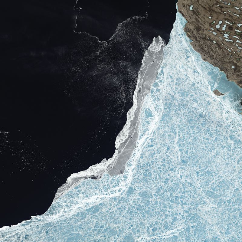
Satellite image showing sea ice edge in the Amundsen Gulf, between Victoria Island and mainland Canada, on 21st June 2015. The gulf forms part of the Northwest Passage, which opened during the low-ice year of 2007 but remained ice-bound in 2014. The summer of 2014 began with relatively cool temperatures in the Arctic and the storms and winds that can break up ice were mostly absent. However, the long-term thinning of sea ice has made it more susceptible to melting, so the 2014 melt season concluded with the sixth-lowest ice extent of the modern satellite era (shown here). (Photo by Science Photo Library Archive)

Reviews
There are no reviews yet.